 Ticketing
  Pass
Pass
 Gift box
  Groups & business


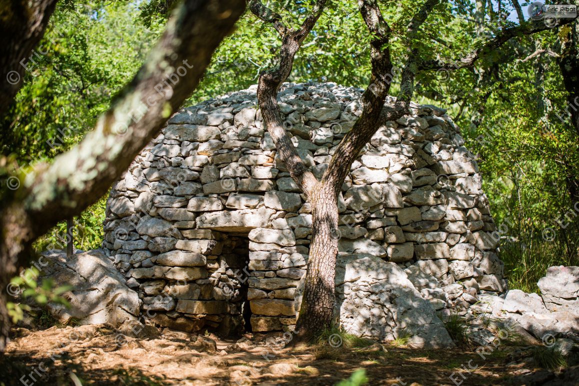
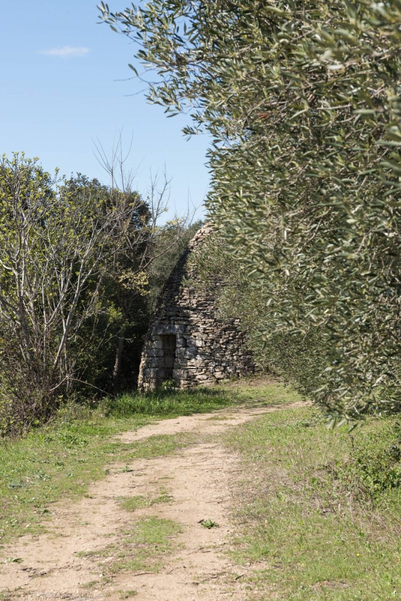
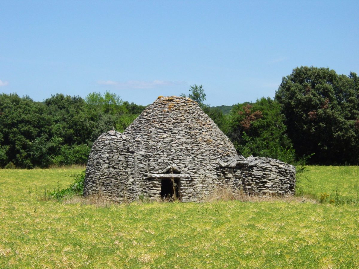
Charming walk on the paths of the garrigue to discover numerous capitelles (dry stone shelters from the 18th and 19th centuries).
Discover the history of this heritage linked to the culture of vines, cereals, olive trees and pastoralism.
From the parking lot of the town hall, turn right to go up the rue de l'hôtel de ville.
At the end of the street, turn right onto "le chemin du pont romain" (signposted circuit des capitelles). Follow the red and white markings of the GR63 Urbain V.
At the sign "Mas du code" take the path on the left (sign "circuit des capitelles"). Sporting ascent with ravines.
At the signpost "Le code" go straight on for 1.8 km.
You pass near the signpost "Chemin de Sares et Prelong" (continue straight on).
At the signpost "Côte Malaïgue" take the path to the left and continue straight on for 700m (yellow markings).
At the signpost "Mas de la Librotte" turn left to "chemin de la Cabane de Guiraud".
Turn left and join the path to discover capitelles, an arboretum and a well.
At the signpost "La Librotte", turn left for 800m.
Reach the signpost "Aillargues", then turn left to join "le Chemin de Sares et Prelong" (GR63 Chemin Urbain V, red and white markings).
Turn right to take back the starting path towards the village of Blauzac.